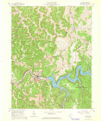
1967 Map of Sutton
USGS Topo · Published 1968About this map
Sutton Lake dominates this mid-century landscape, its controlled waters filling the deep valleys of the Elk River and its numerous tributaries. The town of Sutton sits at a critical bend in the river, where the Baltimore and Ohio railroad infrastructure and a local Radio Tower (WSGB) point to its role as a regional hub. To the east, the extensive Elk River Public Hunting Area preserves a significant portion of the wooded terrain, while the surrounding hills are dotted with family-centered landmarks such as Berry Chapel, Frame Cem, and Sunrise Ch. Small rural outposts like Flatwoods and Pembroke are connected by a network of winding roads and the rail line, including the Berry Siding stop. The presence of numerous gas wells and quarries suggests the extraction industries that supported the local economy alongside the recreational developments surrounding the new reservoir.
Find a feature on this map
70 named features on this map. Tap any name to fly to it.
Don’t see what you’re looking for? This feature index may not catch every label — zoom into the map to look around manually.
Map Details
Editions of this 1967 Sutton Map
2 editions found
Other maps of this area

1893 · Sutton
USGS Topo · 1:125,000

1906 · Glenville
USGS Topo · 1:62,500

1906 · Burnsville
USGS Topo · 1:62,500

1908 · Gassaway
USGS Topo · 1:48,000

1908 · Sutton
USGS Topo · 1:48,000

1910 · Sutton Special
USGS Topo · 1:62,500

1910 · Gassaway
USGS Topo · 1:62,500

1925 · Glenville
USGS Topo · 1:62,500

1925 · Burnsville
USGS Topo · 1:62,500

1927 · Burnsville
USGS Topo · 1:62,500