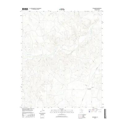
2016 Map of Swearingen
USGS Topo · Published 2016About this map
Swearingen and its surrounding ranchlands are defined by the convergence of several major drainage systems in this rural Cottle County landscape. The Middle Pease River meanders across the central portion of the map, eventually joining the Pease River in the northeastern corner. The town itself is a modest collection of structures located near the intersection of Ranch Rd 104 and several county roads, including Co Rd 354. Local history and genealogy are anchored at the Swearingen Cem, situated just north of the settlement.
Find a feature on this map
16 named features on this map. Tap any name to fly to it.
Don’t see what you’re looking for? This feature index may not catch every label — zoom into the map to look around manually.
Map Details
Editions of this 2016 Swearingen Map
This is the sole edition of this map. No revisions or reprints were ever made.
Other maps of this area

1954 · Plainview
USGS Topo · 1:250,000

1958 · Plainview
USGS Topo · 1:250,000

1967 · Buckle L Ranch
USGS Topo · 1:24,000

1967 · Hell Roaring Creek
USGS Topo · 1:24,000

1967 · Kirkland South
USGS Topo · 1:24,000

1967 · Dunlap
USGS Topo · 1:24,000

1967 · Triangle Ranch
USGS Topo · 1:24,000
1967 · Baker
USGS Topo · 1:24,000

1967 · Paducah
USGS Topo · 1:24,000

1967 · Moons Camp
USGS Topo · 1:24,000