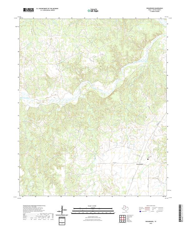
2022 Map of Swearingen
USGS Topo · Published 2022About this map
Swearingen stands as the primary settlement in this Cottle County landscape, situated where the high plains break into the drainage basins of the Pease River system. The topography is defined by the carved paths of the Middle Pease River and the N Pease River, which create a complex network of intermittent streams and draws. Notable watercourses including Owl Cr, Little Nasty Cr, and Big Nasty Cr illustrate the erosive power of water in this semi-arid region. For genealogists and local historians, the Swearingen Cem serves as a vital point of reference for the community’s heritage. The infrastructure is centered around Ranch Rd 104 and several rural routes such as Co Rd 354 and Co Rd 358, which connect the isolated homesteads and ranch lands to the broader regional network.
Find a feature on this map
16 named features on this map. Tap any name to fly to it.
Don’t see what you’re looking for? This feature index may not catch every label — zoom into the map to look around manually.
Map Details
Editions of this 2022 Swearingen Map
This is the sole edition of this map. No revisions or reprints were ever made.
Other maps of this area

1954 · Plainview
USGS Topo · 1:250,000

1958 · Plainview
USGS Topo · 1:250,000

1967 · Buckle L Ranch
USGS Topo · 1:24,000

1967 · Hell Roaring Creek
USGS Topo · 1:24,000

1967 · Kirkland South
USGS Topo · 1:24,000

1967 · Dunlap
USGS Topo · 1:24,000

1967 · Triangle Ranch
USGS Topo · 1:24,000
1967 · Baker
USGS Topo · 1:24,000

1967 · Paducah
USGS Topo · 1:24,000

1967 · Moons Camp
USGS Topo · 1:24,000