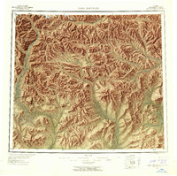
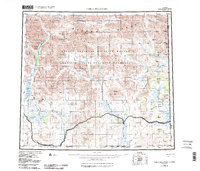
1956 Map of Table Mountain
USGS Topo · Published 1958About this map
The high peaks of the Brooks Range dominate this mid-century survey of the Arctic wilderness along the international boundary. This landscape is defined by the headwaters of several major drainage systems, where the Kongakut River flows north toward the Arctic Ocean while the Sheenjek River and Coleen River wind southward through glaciated valleys. The presence of a single Cabin near the Old Crow River emphasizes the sparse human footprint in this territory during the 1950s.
Find a feature on this map
32 named features on this map. Tap any name to fly to it.
Don’t see what you’re looking for? This feature index may not catch every label — zoom into the map to look around manually.
Map Details
Editions of this 1956 Table Mountain Map
6 editions found
Other maps of this area

1951 · Demarcation Point
USGS Topo · 1:250,000

1951 · Coleen
USGS Topo · 1:250,000

1951 · Christian
USGS Topo · 1:250,000

1951 · Arctic
USGS Topo · 1:250,000

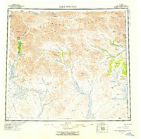
1951 · Table Mountain
USGS Topo · 1:250,000

1951 · Mt. Michelson
USGS Topo · 1:250,000

1955 · Demarcation Point
USGS Topo · 1:250,000

1956 · Table Mountain
USGS Topo · 1:250,000

1956 · Coleen
USGS Topo · 1:250,000

1956 · Arctic
USGS Topo · 1:250,000