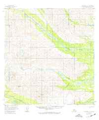
1958 Map of Talkeetna A-5
USGS Topo · Published 1977About this map
The Old Iditarod Trail passes through the southern reaches of this landscape, marking a significant historical corridor across the interior. Surveyed in the late 1950s with limited revisions in the 1970s, this area is defined by the convergence of several major waterways, including the broad Kichatna River and the Happy River. The terrain is characterized by high summits such as Columbia Peak and McDoel Peak, which overlook the braided channels of Johnson Creek and the Nakochna River. The presence of the (Winter Trail) and the Iditarod route reflects the historical importance of seasonal transportation networks in this region before modern infrastructure was established. While no permanent settlements are indicated, the map identifies specific survey markers like VABM 5111 Map and VABM 3862 Wolverine, which served as critical points for early aerial photogrammetric mapping.
Find a feature on this map
11 named features on this map. Tap any name to fly to it.
Don’t see what you’re looking for? This feature index may not catch every label — zoom into the map to look around manually.
Map Details
Editions of this 1958 Talkeetna A-5 Map
3 editions found
Other maps of this area

1949 · Tyonek
USGS Topo · 1:250,000

1950 · Talkeetna
USGS Topo · 1:250,000

1951 · Talkeetna
USGS Topo · 1:250,000

1951 · Tyonek
USGS Topo · 1:250,000

1954 · Talkeetna B-4
USGS Topo · 1:63,360

1954 · Talkeetna A-4
USGS Topo · 1:63,360

1958 · Talkeetna A-6
USGS Topo · 1:63,360

1958 · Tyonek D-6
USGS Topo · 1:63,360

1958 · Talkeetna A-5
USGS Topo · 1:63,360

1958 · Talkeetna B-5
USGS Topo · 1:63,360