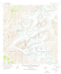
1958 Map of Talkeetna C-5
USGS Topo · Published 1978About this map
Mount Dall dominates this glacial landscape within the Matanuska-Susitna Borough, serving as a high-altitude anchor for the massive ice fields captured in the late 1950s. The flow of the Surprise Glacier and Dall Glacier defines the area's movement, with numerous crevasses indicated across the ice surfaces, signaling the active nature of these frozen giants. These glaciers feed into a network of drainage systems, most notably the Tonzona River in the northwest and the West Fork Yentna River in the south. The presence of Cascade Creek further illustrates the complex watershed formed by the melting ice. This edition, featuring limited revisions through 1976, provides a specialized record of Alaskan glaciology before significant modern retreat, highlighting the sheer scale of the ice-carved terrain and the remote river sources that rely on it.
Find a feature on this map
8 named features on this map. Tap any name to fly to it.
Don’t see what you’re looking for? This feature index may not catch every label — zoom into the map to look around manually.
Map Details
Editions of this 1958 Talkeetna C-5 Map
2 editions found

Other maps of this area

1950 · Talkeetna
USGS Topo · 1:250,000

1951 · Talkeetna
USGS Topo · 1:250,000

1954 · Talkeetna B-4
USGS Topo · 1:63,360

1958 · Talkeetna D-6
USGS Topo · 1:63,360

1958 · Talkeetna B-5
USGS Topo · 1:63,360

1958 · Talkeetna B-6
USGS Topo · 1:63,360

1958 · Talkeetna C-6
USGS Topo · 1:63,360

1958 · Talkeetna D-5
USGS Topo · 1:63,360

1958 · Talkeetna C-4
USGS Topo · 1:63,360

1958 · Talkeetna D-4
USGS Topo · 1:63,360