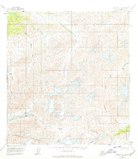
1958 Map of Talkeetna C-6
USGS Topo · Published 1978About this map
The high peaks of the Kichatna Mountains anchor this late-1950s survey of the interior Alaska wilderness. This is a landscape of high-altitude passes and glacial drainage, where the Dillinger River and the West Fork Yentna River begin their descent through the Matanuska-Susitna Borough. Notable features for navigators and mountaineers include Shellabarger Pass and the remote Mystic Pass, located near the headwaters of the Tonzona River. Large ice formations such as Shadows Glacier and Cul-De-Sac Glacier are documented here, showing the extent of permanent snow and ice during the era. The mapping of the Big Salmon Fork and Little Tonzona River reveals the complex hydrologic network of this unpopulated region, captured through 1957 aerial photography and field annotated in 1958.
Find a feature on this map
14 named features on this map. Tap any name to fly to it.
Don’t see what you’re looking for? This feature index may not catch every label — zoom into the map to look around manually.
Map Details
Editions of this 1958 Talkeetna C-6 Map
3 editions found
Other maps of this area

1949 · McGrath
USGS Topo · 1:250,000

1950 · McGrath
USGS Topo · 1:250,000

1950 · Talkeetna
USGS Topo · 1:250,000

1951 · Talkeetna
USGS Topo · 1:250,000

1958 · Talkeetna D-6
USGS Topo · 1:63,360

1958 · Talkeetna B-5
USGS Topo · 1:63,360

1958 · Talkeetna B-6
USGS Topo · 1:63,360

1958 · Talkeetna C-6
USGS Topo · 1:63,360

1958 · McGrath B-1
USGS Topo · 1:63,360

1958 · Talkeetna D-5
USGS Topo · 1:63,360