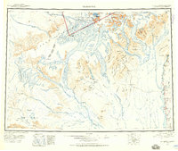
1958 Map of Talkeetna
USGS Topo · Published 1968About this map
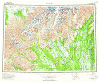
Mount McKinley National Park anchors the northern extent of this Alaskan wilderness, where the high peaks of the Alaska Range meet a complex network of glacial rivers. The cartography reveals a landscape shaped by ice, dominated by the massive Kahiltna Glacier, Yentna Glacier, and Ruth Glacier, which feed the southern-flowing Chulitna River and Susitna River. Human presence is concentrated near the confluence of these major waterways at Talkeetna and along the Winter Trail leading toward the mining and trapping outposts of Petersville and Collinsville. A segment of the Old Iditarod Trail is visible in the southwest, cutting across the Happy River and Simpson Pass, marking the historic route for dog sled teams and gold seekers navigating the passes toward the interior. The map captures the frontier character of the Matanuska-Susitna Borough before modern infrastructure reached deep into the drainage basins of the Yentna River.
Find a feature on this map
67 named features on this map. Tap any name to fly to it.
Don’t see what you’re looking for? This feature index may not catch every label — zoom into the map to look around manually.
Map Details
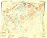
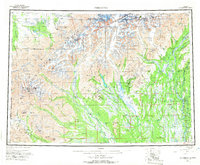
Editions of this 1958 Talkeetna Map
5 editions found
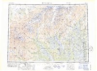
Historical Maps of Talkeetna Through Time
4 maps found