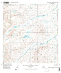
1951 Map of Talkeetna Mountains B-2
USGS Topo · Published 1971About this map
The Talkeetna Mountains define this high-altitude landscape as it was mapped in the early 1950s, revealing a wilderness defined entirely by its complex drainage systems. The Oshetna River and Black River dominate the central topography, fed by numerous family-named tributaries like George Creek, Busch Creek, and Gold Creek. This survey, based on 1949 aerial photography, documents the region before any road infrastructure or trails were established, preserving a record of the natural hydrology including Black Lake and the prominent Crater Lake. The presence of features like Twin Hills and Granite Creek provides specific landmarks for geologists and backcountry researchers interested in the pristine state of the Alaskan interior during this era of federal mapping.
Find a feature on this map
12 named features on this map. Tap any name to fly to it.
Don’t see what you’re looking for? This feature index may not catch every label — zoom into the map to look around manually.
Map Details
Editions of this 1951 Talkeetna Mountains B-2 Map
3 editions found
Other maps of this area

1949 · Talkeetna Mountains A-1
USGS Topo · 1:63,360

1950 · Talkeetna Mountains
USGS Topo · 1:250,000

1951 · Talkeetna Mountains B-1
USGS Topo · 1:63,360

1951 · Talkeetna Mountains A-2
USGS Topo · 1:63,360

1951 · Talkeetna Mountains C-2
USGS Topo · 1:63,360

1951 · Talkeetna Mountains B-3
USGS Topo · 1:63,360

1951 · Talkeetna Mountains A-3
USGS Topo · 1:63,360

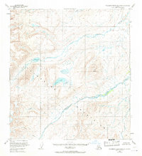
1951 · Talkeetna Mountains B-2
USGS Topo · 1:63,360

1951 · Talkeetna Mountains C-1
USGS Topo · 1:63,360

1951 · Talkeetna Mountains C-3
USGS Topo · 1:63,360