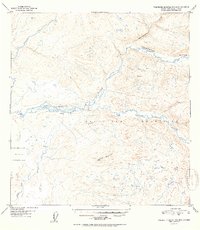
1952 Map of Talkeetna Mountains B-6
USGS Topo · Published 1952About this map
The Talkeetna River serves as the central artery of this interior Alaskan landscape, documented here just before statehood. Flowing west through the Talkeetna Mountains, the river's braided channels are joined by major tributaries including the Sheep River and Chunilna Creek. The mapping effort, based on 1949 aerial photography, reveals the extreme isolation of the territory, where a solitary Cabin near the riverbanks is one of the few signs of human habitation. High points like Bald Mountain provide topographical anchors for the sheet, though a portion of the western terrain remains a mystery, marked as No compilation available due to cloud cover during the survey flight. This map captures a wilderness in its rawest form, where named features like Disappointment Creek and Birch Creek are the only guides through the dense contour lines.
Find a feature on this map
11 named features on this map. Tap any name to fly to it.
Don’t see what you’re looking for? This feature index may not catch every label — zoom into the map to look around manually.
Map Details
Editions of this 1952 Talkeetna Mountains B-6 Map
2 editions found

Other maps of this area

1949 · Talkeetna Mountains B-6
USGS Topo · 1:63,360

1949 · Talkeetna Mountains C-6
USGS Topo · 1:63,360

1950 · Talkeetna Mountains
USGS Topo · 1:250,000

1950 · Talkeetna
USGS Topo · 1:250,000

1950 · Talkeetna Mountains B-5
USGS Topo · 1:63,360

1950 · Talkeetna Mountains A-6
USGS Topo · 1:63,360

1950 · Talkeetna Mountains A-5
USGS Topo · 1:63,360

1950 · Talkeetna Mountains C-5
USGS Topo · 1:63,360

1951 · Talkeetna
USGS Topo · 1:250,000

1951 · Talkeetna B-1
USGS Topo · 1:63,360