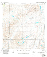
1951 Map of Talkeetna Mountains C-3
USGS Topo · Published 1980About this map
Talkeetna Mountains dominate this mid-century topographic survey, showing a high-altitude landscape defined by glacially-carved valleys and drainage networks. The northern portion of the map is anchored by Mt Watana and the nearby Watana Lake, while a series of parallel waterways including Kosina Creek and Tsisi Creek flow through the central terrain. Based on 1949 aerial photography, the map documents a primitive wilderness state with no roads or trails recorded at the time of the 1951 field annotation. The drainage patterns of Fog Creek and Terrace Creek illustrate the complex hydrology of this subarctic environment before modern infrastructure reached this part of the Matanuska-Susitna Borough. The absence of human-made landmarks emphasizes the topographical focus of the U.S. Geological Survey during this era of Alaskan mapping.
Find a feature on this map
9 named features on this map. Tap any name to fly to it.
Don’t see what you’re looking for? This feature index may not catch every label — zoom into the map to look around manually.
Map Details
Editions of this 1951 Talkeetna Mountains C-3 Map
3 editions found
Other maps of this area

1950 · Talkeetna Mountains
USGS Topo · 1:250,000

1950 · Talkeetna Mountains B-4
USGS Topo · 1:63,360

1951 · Talkeetna Mountains C-2
USGS Topo · 1:63,360

1951 · Talkeetna Mountains B-3
USGS Topo · 1:63,360

1951 · Talkeetna Mountains D-2
USGS Topo · 1:63,360

1951 · Talkeetna Mountains B-2
USGS Topo · 1:63,360

1951 · Talkeetna Mountains C-4
USGS Topo · 1:63,360

1951 · Talkeetna Mountains D-3
USGS Topo · 1:63,360

1951 · Talkeetna Mountains D-4
USGS Topo · 1:63,360

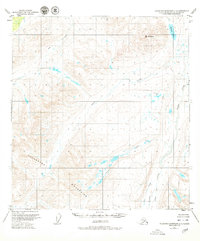
1951 · Talkeetna Mountains C-3
USGS Topo · 1:63,360