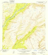
1952 Map of Talkeetna Mountains C-6
USGS Topo · Published 1952About this map
The Alaska Railroad traces the high bank of the Susitna River in this mid-century survey, providing a vital transportation artery through the northern wilderness. The small siding at Sherman sits as a lonely outpost along the tracks, positioned near the confluence where several drainage systems meet the main river channel. The topography is dominated by the western reaches of the Talkeetna Mountains, characterized by sharp elevation changes and numerous survey markers such as VABM 3710 Chunilna and VABM 3631 Curry.
Find a feature on this map
13 named features on this map. Tap any name to fly to it.
Don’t see what you’re looking for? This feature index may not catch every label — zoom into the map to look around manually.
Map Details
Editions of this 1952 Talkeetna Mountains C-6 Map
2 editions found

Other maps of this area

1949 · Talkeetna Mountains D-6
USGS Topo · 1:63,360

1949 · Talkeetna Mountains B-6
USGS Topo · 1:63,360

1949 · Talkeetna Mountains C-6
USGS Topo · 1:63,360

1950 · Talkeetna Mountains
USGS Topo · 1:250,000

1950 · Talkeetna
USGS Topo · 1:250,000

1950 · Talkeetna Mountains B-5
USGS Topo · 1:63,360

1950 · Talkeetna Mountains D-5
USGS Topo · 1:63,360

1950 · Talkeetna Mountains C-5
USGS Topo · 1:63,360

1951 · Talkeetna
USGS Topo · 1:250,000

1951 · Talkeetna B-1
USGS Topo · 1:63,360