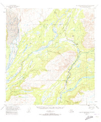
1951 Map of Talkeetna Mountains D-6
USGS Topo · Published 1973About this map
The Alaska Railroad defines the transportation corridor of this mid-century subarctic landscape, following the narrow valleys of the Indian River and Chulitna River. The mapping captures a critical infrastructure network where steel rails connect isolated stations like Hurricane, Canyon, and Gold Creek. To the west, the massive Eldridge Glacier and Fountain River dominate the glacial terrain, while the central portion of the sheet reveals the early extent of Denali State Park. Local travel is marked by traditional routes such as the Sled Road winding through the eastern hills. The confluence of the Susitna River and Gold Creek in the south highlights a landscape shaped by powerful waterways and the technical demands of maintaining a rail line through the Chulitna Pass and past landmarks like the Gaging Sta.
Find a feature on this map
26 named features on this map. Tap any name to fly to it.
Don’t see what you’re looking for? This feature index may not catch every label — zoom into the map to look around manually.
Map Details
Editions of this 1951 Talkeetna Mountains D-6 Map
4 editions found

Other maps of this area

1949 · Talkeetna Mountains D-6
USGS Topo · 1:63,360

1949 · Talkeetna Mountains C-6
USGS Topo · 1:63,360

1949 · Healy A-6
USGS Topo · 1:63,360

1950 · Talkeetna Mountains
USGS Topo · 1:250,000

1950 · Talkeetna
USGS Topo · 1:250,000

1950 · Talkeetna Mountains D-5
USGS Topo · 1:63,360

1950 · Healy A-5
USGS Topo · 1:63,360

1950 · Talkeetna Mountains C-5
USGS Topo · 1:63,360

1951 · Talkeetna
USGS Topo · 1:250,000

1951 · Healy
USGS Topo · 1:250,000