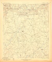
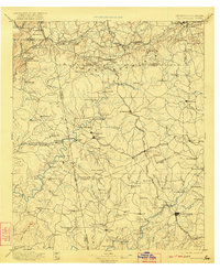
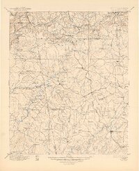
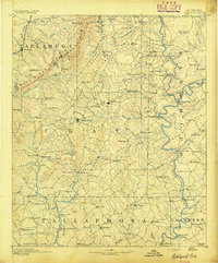
1897 Map of Tallapoosa
USGS Topo · Published 1905About this map
Dugdown Mountain dominates the northern landscape of this survey, forming a prominent ridge that defines the geography of Polk and Haralson counties. The Tallapoosa River meanders through the central terrain, its course marked by vital early infrastructure including Rainwater Ford and Mc.Bride Bridge. This late-19th-century mapping effort by Louis Nell and M. Hackett captures the region's agricultural and industrial transition, evidenced by the numerous water-powered sites such as Roberts Mill, Munroe Mill, and Allgoods Mill.
Find a feature on this map
168 named features on this map. Tap any name to fly to it.
Don’t see what you’re looking for? This feature index may not catch every label — zoom into the map to look around manually.
Map Details
Editions of this 1897 Tallapoosa Map
4 editions found

Other maps of this area

1886 · Rome
USGS Topo · 1:125,000

1889 · Tallapoosa
USGS Topo · 1:125,000

1890 · Cartersville
USGS Topo · 1:125,000

1891 · Marietta
USGS Topo · 1:125,000

1891 · Cartersville
USGS Topo · 1:125,000
1891 · Ashland
USGS Topo · 1:125,000

1892 · Tallapoosa
USGS Topo · 1:125,000

1893 · Fort Payne
USGS Topo · 1:125,000

1895 · Marietta
USGS Topo · 1:125,000

1896 · Cartersville
USGS Topo · 1:125,000