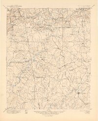
1897 Map of Tallapoosa
USGS Topo · Published 1944About this map
Dugdown Mountain creates a natural divide across this terrain where Georgia meets Alabama, anchoring a landscape defined by its river crossings and early industrial sites. The upper reaches of the Tallapoosa River and the Little Tallapoosa River wind through the region, supporting a network of water-powered infrastructure such as Simpson Mill, Allgoods Mill, and Hightower Mill. The settlement pattern in the late 19th century reflects the heavy influence of competing rail lines, including the Southern R.R. and the Chattanooga Rome and Columbus R.R., which connected centers like Tallapoosa and Bremen to the wider commerce of the South. Away from the tracks, the map details many local landmarks essential for family history research, from Pinewood Church to critical river transits like Rainwater Ford and McBride Bridge.
Find a feature on this map
148 named features on this map. Tap any name to fly to it.
Don’t see what you’re looking for? This feature index may not catch every label — zoom into the map to look around manually.
Map Details
Editions of this 1897 Tallapoosa Map
4 editions found

Other maps of this area

1886 · Rome
USGS Topo · 1:125,000

1889 · Tallapoosa
USGS Topo · 1:125,000

1890 · Cartersville
USGS Topo · 1:125,000

1891 · Marietta
USGS Topo · 1:125,000

1891 · Cartersville
USGS Topo · 1:125,000

1891 · Ashland
USGS Topo · 1:125,000

1892 · Tallapoosa
USGS Topo · 1:125,000

1893 · Fort Payne
USGS Topo · 1:125,000

1895 · Marietta
USGS Topo · 1:125,000

1896 · Cartersville
USGS Topo · 1:125,000