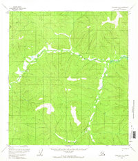
1956 Map of Tanacross B-2
USGS Topo · Published 1966About this map
Ladue River meanders through the heart of this terrain, its course defined by tight switchbacks across the valley floor as it flows generally eastward. Captured during a period of extensive photogrammetric mapping in the mid-1950s, this sheet reveals a landscape dominated by high ridges and drainage basins. The South Fork joins the larger river system from the south, marking a significant hydrologic junction in an area largely devoid of formal settlements or industrial development at the time of the survey. The absence of roads and named human markers underscores the wilderness character of the region, emphasizing the natural topography and the intricate drainage network that defines the Tanacross quadrangle. This map serves as a baseline for the region's hydrography and elevation before later 20th-century shifts in land use or environmental change.
Find a feature on this map
2 named features on this map. Tap any name to fly to it.
Don’t see what you’re looking for? This feature index may not catch every label — zoom into the map to look around manually.
Map Details
Editions of this 1956 Tanacross B-2 Map
2 editions found
Other maps of this area

1948 · Tanacross A-3
USGS Topo · 1:63,360

1948 · Tanacross B-3
USGS Topo · 1:63,360

1949 · Tanacross
USGS Topo · 1:250,000

1949 · Tanacross B-3
USGS Topo · 1:63,360

1950 · Tanacross
USGS Topo · 1:250,000

1952 · Tanacross A-3
USGS Topo · 1:63,360

1952 · Tanacross B-3
USGS Topo · 1:63,360

1952 · Tanacross A-1
USGS Topo · 1:63,360

1954 · Tanacross A-2
USGS Topo · 1:63,360

1955 · Tanacross A-2
USGS Topo · 1:63,360