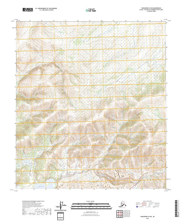
2024 Map of Tanacross B-4 NE
USGS Topo · Published 2024About this map
Taylor Highway cuts through the southeastern corner of this Alaskan interior landscape, providing the primary overland access through a region defined by complex drainage patterns. The Tanana River skims the southwestern edge of the quadrangle, while smaller waterways like Porcupine Creek and Dennison Fork wind through the hills to the east. The terrain is marked by the systematic grid of the Public Land Survey System, including t19n r14e and t20n r15e, which organize this largely undeveloped territory. This 2024 data reflects the current topographic character of the Southeast Fairbanks Census Area, documenting the precise routes of high-latitude interior roads and the natural flow of glacial and mountain-fed streams.
Find a feature on this map
9 named features on this map. Tap any name to fly to it.
Don’t see what you’re looking for? This feature index may not catch every label — zoom into the map to look around manually.
Map Details
Editions of this 2024 Tanacross B-4 NE Map
This is the sole edition of this map. No revisions or reprints were ever made.
Other maps of this area

1948 · Tanacross B-3
USGS Topo · 1:63,360

1949 · Tanacross
USGS Topo · 1:250,000

1949 · Tanacross B-4
USGS Topo · 1:63,360

1949 · Tanacross B-3
USGS Topo · 1:63,360

1950 · Tanacross
USGS Topo · 1:250,000

1951 · Tanacross B-4
USGS Topo · 1:63,360

1952 · Tanacross B-3
USGS Topo · 1:63,360

1956 · Tanacross C-3
USGS Topo · 1:63,360
1956 · Tanacross C-4
USGS Topo · 1:63,360

1956 · Tanacross
USGS Topo · 1:250,000