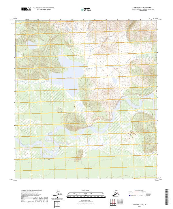
2024 Map of Tanacross B-5 NE
USGS Topo · Published 2024About this map
The braided channels of the Tanana River dominate this interior Alaskan landscape, shaping the development of the riverbank settlements of Tanacross and Tok. As the river winds through the southern portion of the quadrangle, it creates a complex network of wetlands and silt deposits that have historically influenced access to this region. To the north, the terrain transitions into more stable ground where Wolf Lake sits as a significant inland water body. The mapping of these townships, including t19n r12e and t20n r12e, reflects a wilderness environment where human presence is concentrated at specific crossroads and traditional river crossings, providing a clear record of the intersection between natural hydrology and early 21st-century Alaskan geography.
Find a feature on this map
12 named features on this map. Tap any name to fly to it.
Don’t see what you’re looking for? This feature index may not catch every label — zoom into the map to look around manually.
Map Details
Editions of this 2024 Tanacross B-5 NE Map
This is the sole edition of this map. No revisions or reprints were ever made.
Other maps of this area

1948 · Tanacross B-5
USGS Topo · 1:63,360

1949 · Tanacross
USGS Topo · 1:250,000

1949 · Tanacross B-4
USGS Topo · 1:63,360

1950 · Tanacross
USGS Topo · 1:250,000

1951 · Tanacross B-4
USGS Topo · 1:63,360

1952 · Tanacross B-5
USGS Topo · 1:63,360
1956 · Tanacross C-5
USGS Topo · 1:63,360
1956 · Tanacross C-4
USGS Topo · 1:63,360

1956 · Tanacross
USGS Topo · 1:250,000

1964 · Tanacross
USGS Topo · 1:250,000