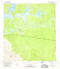
1948 Map of Tanacross B-5
USGS Topo · Published 1969About this map
Tanacross sits along the northern banks of the winding Tanana River, serving as a central hub for the interior transportation networks that defined mid-century Alaska. This 1948 survey, published decades later, illustrates the critical intersection of the Alaska Highway and the Glenn Highway as they converge near the Tanacross Airfield. The landscape is dominated by complex water systems, including the braidings of the Tanana Slough and Little Tanana Slough, which stand in contrast to the high peaks of the Alaska Range and Mount Neuberger in the southwest.
Find a feature on this map
29 named features on this map. Tap any name to fly to it.
Don’t see what you’re looking for? This feature index may not catch every label — zoom into the map to look around manually.
Map Details
Editions of this 1948 Tanacross B-5 Map
3 editions found
Other maps of this area

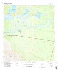
1948 · Tanacross B-5
USGS Topo · 1:63,360

1948 · Tanacross A-6
USGS Topo · 1:63,360

1948 · Tanacross A-4
USGS Topo · 1:63,360

1948 · Tanacross A-5
USGS Topo · 1:63,360

1949 · Tanacross
USGS Topo · 1:250,000

1949 · Tanacross B-4
USGS Topo · 1:63,360

1949 · Tanacross A-5
USGS Topo · 1:63,360

1949 · Tanacross B-6
USGS Topo · 1:63,360

1950 · Tanacross
USGS Topo · 1:250,000

1951 · Tanacross B-6
USGS Topo · 1:63,360