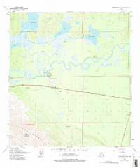
1948 Map of Tanacross B-5
USGS Topo · Published 1996About this map
Tanacross and the nearby Tanacross Airfield serve as the focal point of this 1948 Alaskan interior landscape, situated at the confluence of the Tanana River and the winding Little Tanana Slough. The area represents a critical intersection of post-war transportation, where the Alaska Highway meets the historic Eagle Trail. This junction signifies the transition from the river-and-trail-dependent era to the modern highway system that defined mid-century development in the Interior.
Find a feature on this map
35 named features on this map. Tap any name to fly to it.
Don’t see what you’re looking for? This feature index may not catch every label — zoom into the map to look around manually.
Map Details
Editions of this 1948 Tanacross B-5 Map
3 editions found
Other maps of this area

1948 · Tanacross B-5
USGS Topo · 1:63,360

1948 · Tanacross A-6
USGS Topo · 1:63,360

1948 · Tanacross A-4
USGS Topo · 1:63,360

1948 · Tanacross A-5
USGS Topo · 1:63,360

1949 · Tanacross
USGS Topo · 1:250,000

1949 · Tanacross B-4
USGS Topo · 1:63,360

1949 · Tanacross A-5
USGS Topo · 1:63,360

1949 · Tanacross B-6
USGS Topo · 1:63,360

1950 · Tanacross
USGS Topo · 1:250,000

1951 · Tanacross B-6
USGS Topo · 1:63,360