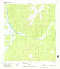
1956 Map of Tanacross C-2
USGS Topo · Published 1968About this map
Prindle Volcano dominates the northern landscape of this remote interior region, serving as a rare geological landmark in the Tanacross area. The terrain is defined by the winding paths of the Dennison Fork and the East Fork, which carve through a mosaic of wetlands and unmapped hills. A solitary Cabin and a designated Winter Trail in the northwest indicate the sparse human presence and the seasonal nature of travel in this subarctic environment during the mid-1950s. The identification of a Pingo in the southeast highlights the permafrost-driven geomorphology that characterizes this section of the Yukon-Tanana Uplands, where land lines remained largely unsurveyed by the Bureau of Land Management at the time of this study.
Find a feature on this map
6 named features on this map. Tap any name to fly to it.
Don’t see what you’re looking for? This feature index may not catch every label — zoom into the map to look around manually.
Map Details
Editions of this 1956 Tanacross C-2 Map
2 editions found

Other maps of this area

1948 · Tanacross B-3
USGS Topo · 1:63,360

1949 · Tanacross
USGS Topo · 1:250,000

1949 · Tanacross B-3
USGS Topo · 1:63,360

1950 · Tanacross
USGS Topo · 1:250,000

1952 · Tanacross B-3
USGS Topo · 1:63,360

1956 · Tanacross D-3
USGS Topo · 1:63,360

1956 · Tanacross C-1
USGS Topo · 1:63,360

1956 · Tanacross D-2
USGS Topo · 1:63,360
1956 · Tanacross B-1
USGS Topo · 1:63,360

1956 · Tanacross C-3
USGS Topo · 1:63,360