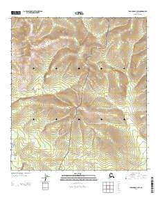
2013 Map of Tanacross C-3 SW
USGS Topo · Published 2013About this map
Taylor Hwy snakes through this high-elevation interior landscape, serving as the primary corridor through the mountainous terrain of the Southeast Fairbanks region. The route follows a ridgeline, a common characteristic of Alaskan highway engineering where roadbeds are kept on higher ground to avoid the drainage and permafrost issues of the valley floors. Branching away from the main road, the Winter Trl provides seasonal access across the topography. This survey captures a moment of modern continuity in a remote area where transportation routes are dictated almost entirely by the steep contours of the surrounding peaks. The map lacks formal settlements, focusing instead on the essential infrastructure that connects this part of Alaska to the broader road network.
Find a feature on this map
4 named features on this map. Tap any name to fly to it.
Don’t see what you’re looking for? This feature index may not catch every label — zoom into the map to look around manually.
Map Details
Editions of this 2013 Tanacross C-3 SW Map
This is the sole edition of this map. No revisions or reprints were ever made.
Other maps of this area

1948 · Tanacross B-3
USGS Topo · 1:63,360

1949 · Tanacross
USGS Topo · 1:250,000

1949 · Tanacross B-4
USGS Topo · 1:63,360

1949 · Tanacross B-3
USGS Topo · 1:63,360

1950 · Tanacross
USGS Topo · 1:250,000

1951 · Tanacross B-4
USGS Topo · 1:63,360

1952 · Tanacross B-3
USGS Topo · 1:63,360

1956 · Tanacross C-3
USGS Topo · 1:63,360
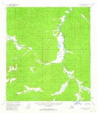
1956 · Tanacross C-4
USGS Topo · 1:63,360

1956 · Tanacross
USGS Topo · 1:250,000