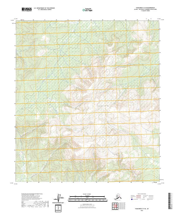
2024 Map of Tanacross C-5 SE
USGS Topo · Published 2024About this map
Sixtymile Butte stands as the dominant topographical feature in this interior Alaskan wilderness, a region defined by high elevations and the meandering path of the West Fork Dennison Fork. The landscape is largely undeveloped, shown here through a modern lens that emphasizes the intricate drainage patterns and rising terrain of the Southeast Fairbanks Census Area. The absence of roads or permanent settlements within these township boundaries — including t21n r11e, t21n r12e, and t20n r12e — highlights the remote character of this subarctic environment where water and elevation dictate the logic of the land.
Find a feature on this map
7 named features on this map. Tap any name to fly to it.
Don’t see what you’re looking for? This feature index may not catch every label — zoom into the map to look around manually.
Map Details
Editions of this 2024 Tanacross C-5 SE Map
This is the sole edition of this map. No revisions or reprints were ever made.
Other maps of this area

1948 · Tanacross B-5
USGS Topo · 1:63,360

1949 · Tanacross
USGS Topo · 1:250,000

1949 · Tanacross B-4
USGS Topo · 1:63,360

1950 · Tanacross
USGS Topo · 1:250,000

1951 · Tanacross B-4
USGS Topo · 1:63,360

1952 · Tanacross B-5
USGS Topo · 1:63,360
1956 · Tanacross C-5
USGS Topo · 1:63,360
1956 · Tanacross C-4
USGS Topo · 1:63,360

1956 · Tanacross
USGS Topo · 1:250,000

1964 · Tanacross
USGS Topo · 1:250,000