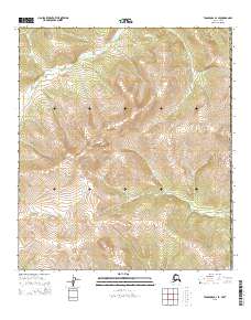
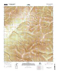
2015 Map of Tanacross D-1 SE
USGS Topo · Published 2015About this map
Divide Mtn stands as a central topographic landmark in this high-altitude landscape within the Southeast Fairbanks Census Area. The terrain is defined by the headwaters and winding courses of major subarctic waterways, specifically the Sixtymile River which snakes through the southern and western sections, and the N Ladue River flowing through the eastern reaches. A sharp dramatic turn in the river corridor is preserved at Fishhook Bend, reflecting the erosional patterns of this unpopulated wilderness. The map details the complex drainage patterns of these rivers as they navigate significant elevation changes, providing a clear record of the area's natural hydrology and land divisions including t24n r22e and t23n r22e along the border of the United States.
Find a feature on this map
12 named features on this map. Tap any name to fly to it.
Don’t see what you’re looking for? This feature index may not catch every label — zoom into the map to look around manually.
Map Details
Editions of this 2015 Tanacross D-1 SE Map
This is the sole edition of this map. No revisions or reprints were ever made.
Other maps of this area

1949 · Tanacross
USGS Topo · 1:250,000

1950 · Tanacross
USGS Topo · 1:250,000

1956 · Tanacross C-1
USGS Topo · 1:63,360

1956 · Tanacross D-1
USGS Topo · 1:63,360

1956 · Tanacross
USGS Topo · 1:250,000

1964 · Tanacross
USGS Topo · 1:250,000
2013 · Tanacross D-1 NE
USGS Topo · 1:25,000
2013 · Tanacross D-1 NW
USGS Topo · 1:25,000
2015 · Tanacross C-1 NE
USGS Topo · 1:25,000
2015 · Tanacross C-1 NW
USGS Topo · 1:25,000