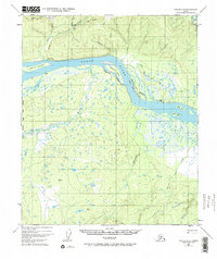
1952 Map of Tanana A-6
USGS Topo · Published 1971About this map
The Yukon River carves a massive path through this Interior Alaska landscape, flanked by a network of complex waterways and islands. Near the riverbanks, human activity is marked by an Indian Village and a nearby Cem, alongside scattered Cabins that speak to the subsistence and transit patterns of the mid-20th century. To the north, the terrain rises toward Gold Hill, where a Placer Mine and several Trail networks suggest a history of mineral exploration.
Find a feature on this map
35 named features on this map. Tap any name to fly to it.
Don’t see what you’re looking for? This feature index may not catch every label — zoom into the map to look around manually.
Map Details
Editions of this 1952 Tanana A-6 Map
3 editions found
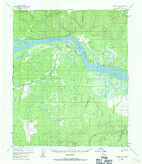
Other maps of this area

1948 · Kantishna River
USGS Topo · 1:250,000

1951 · Kantishna River
USGS Topo · 1:250,000

1951 · Ruby
USGS Topo · 1:250,000

1951 · Melozitna
USGS Topo · 1:250,000

1951 · Tanana
USGS Topo · 1:250,000

1952 · Kantishna River D-5
USGS Topo · 1:63,360

1952 · Ruby D-1
USGS Topo · 1:63,360

1952 · Kantishna River
USGS Topo · 1:250,000

1952 · Tanana A-6
USGS Topo · 1:63,360

1952 · Kantishna River D-6
USGS Topo · 1:63,360