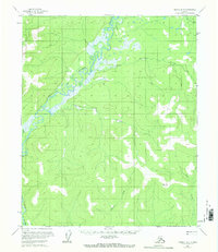
1956 Map of Tanana B-5
USGS Topo · Published 1968About this map
The Tozitna River winds through the heart of this Yukon-Koyukuk landscape, defining a network of drainages and wetlands in the Alaskan interior. Surveyed in the early 1950s, the terrain is characterized by its dramatic elevation changes and named waterways that reflect the local fauna and the challenging nature of the land. Significant tributaries such as Reindeer Creek and Ptarmigan Creek flow from the higher elevations toward the river valley, while the curiously named Hellbent Creek suggests the character of the trek through this unpopulated wilderness. In the southern reaches, Tenmile Creek and Bear Creek cut through the ridges, eventually leading toward the high point at VABM 2184 Bear. This map captures a moment before modern development, showing the natural hydrology and topographical landmarks used by those navigating this interior territory.
Find a feature on this map
7 named features on this map. Tap any name to fly to it.
Don’t see what you’re looking for? This feature index may not catch every label — zoom into the map to look around manually.
Map Details
Editions of this 1956 Tanana B-5 Map
2 editions found
Other maps of this area

1951 · Tanana
USGS Topo · 1:250,000

1952 · Tanana A-4
USGS Topo · 1:63,360

1952 · Tanana A-6
USGS Topo · 1:63,360

1952 · Tanana A-5
USGS Topo · 1:63,360

1953 · Tanana A-5
USGS Topo · 1:63,360

1956 · Tanana B-5
USGS Topo · 1:63,360

1956 · Tanana B-6
USGS Topo · 1:63,360

1956 · Tanana C-6
USGS Topo · 1:63,360

1956 · Tanana C-5
USGS Topo · 1:63,360

1956 · Tanana C-4
USGS Topo · 1:63,360