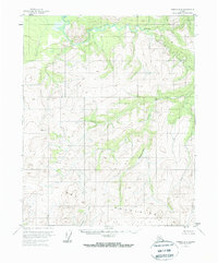
1956 Map of Tanana D-4
USGS Topo · Published 1972About this map
Kanuti River and the Kilolitna River converge in this northern Alaskan interior landscape, where the drainage patterns of the subarctic wilderness are meticulously documented. Field annotated in the mid-1950s, the map reveals a terrain defined by complex watercourses and significant elevations, including the broad heights of the Mountain S range to the south. This area, managed in part by the Bureau of Land Management, shows no roads or trails, illustrating the pure reliance on river systems like Ishtalitna Creek and Banddana Creek for navigation through the brush and tundra. The survey captures the land as it existed before modern shifts in environmental management, providing a baseline for the hydrological character of the Yukon-Koyukuk region.
Find a feature on this map
5 named features on this map. Tap any name to fly to it.
Don’t see what you’re looking for? This feature index may not catch every label — zoom into the map to look around manually.
Map Details
Editions of this 1956 Tanana D-4 Map
3 editions found
Other maps of this area

1951 · Bettles
USGS Topo · 1:250,000

1951 · Tanana
USGS Topo · 1:250,000

1956 · Bettles
USGS Topo · 1:250,000

1956 · Tanana D-4
USGS Topo · 1:63,360

1956 · Tanana D-3
USGS Topo · 1:63,360

1956 · Tanana C-3
USGS Topo · 1:63,360

1956 · Tanana C-5
USGS Topo · 1:63,360
1956 · Tanana D-5
USGS Topo · 1:63,360

1956 · Tanana C-4
USGS Topo · 1:63,360

1956 · Tanana
USGS Topo · 1:250,000