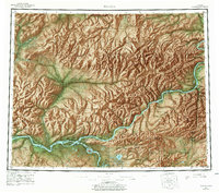
1960 Map of Tanana
USGS Topo · Published 1978About this map
The Yukon River serves as the central artery for this interior Alaskan landscape, which reflects a mid-20th-century frontier economy centered on river transport and small-scale mining. Near the confluence with the Tanana River, the settlement of Tanana is marked alongside Mission Hill and a Cem, indicating a hub of local history and genealogy. Upriver, the town of Rampart and the Placer Mine near Eureka speak to the region's mineral wealth, while Manley Hot Springs and Hot Springs Landing highlight the importance of geothermal sites for early development.
Find a feature on this map
113 named features on this map. Tap any name to fly to it.
Don’t see what you’re looking for? This feature index may not catch every label — zoom into the map to look around manually.
Map Details
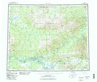
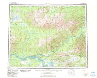
Editions of this 1960 Tanana Map
4 editions found

Other maps of this area

1945 · Livengood
USGS Topo · 1:250,000

1948 · Kantishna River
USGS Topo · 1:250,000

1950 · Fairbanks
USGS Topo · 1:250,000

1951 · Kantishna River
USGS Topo · 1:250,000

1951 · Ruby
USGS Topo · 1:250,000

1951 · Fairbanks
USGS Topo · 1:250,000

1951 · Hughes
USGS Topo · 1:250,000

1951 · Melozitna
USGS Topo · 1:250,000

1951 · Bettles
USGS Topo · 1:250,000

1951 · Tanana
USGS Topo · 1:250,000