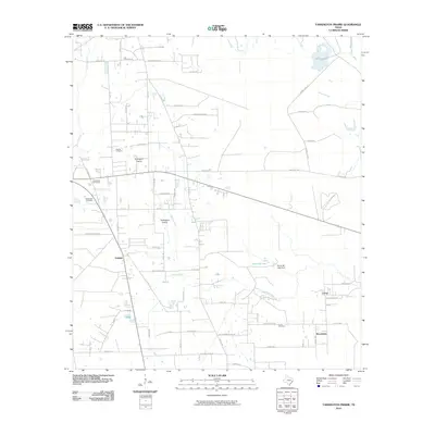
2010 Map of Tarkington Prairie
USGS Topo · Published 2010About this map
Tarkington Prairie and the surrounding Liberty County coastal plain appear here in a transition toward residential development alongside long-standing rural landmarks. The landscape is defined by its drainages, where Gaylor Creek, Indian Gulley, and Thickets Creek thread through the piney woods toward Davis Bayou. This geography dictated the placement of early settlements and family burial grounds, including the Boothe Cemetery and McGinnis Cemetery.
Find a feature on this map
59 named features on this map. Tap any name to fly to it.
Don’t see what you’re looking for? This feature index may not catch every label — zoom into the map to look around manually.
Map Details
Editions of this 2010 Tarkington Prairie Map
This is the sole edition of this map. No revisions or reprints were ever made.
Other maps of this area

1943 · Liberty
USGS Topo · 1:125,000

1954 · Beaumont
USGS Topo · 1:250,000

1955 · Rayburn
USGS Topo · 1:62,500

1955 · Liberty
USGS Topo · 1:62,500

1957 · Beaumont
USGS Topo · 1:250,000

1958 · Cleveland
USGS Topo · 1:24,000

1958 · Westcott
USGS Topo · 1:24,000

1959 · Plum Grove
USGS Topo · 1:24,000

1984 · Beaumont
USGS Topo · 1:250,000
1984 · Rayburn
USGS Topo · 1:24,000