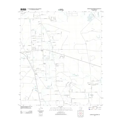
2013 Map of Tarkington Prairie
USGS Topo · Published 2013About this map
Tarkington Prairie serves as the focal point for this rural Liberty County landscape, where small crossroads communities like Oakdale and Lumm are dispersed among numerous creeks and drainages. The area is defined by its low-lying hydrology, with Gaylor Cr and Thickets Creek winding through the terrain toward Board Slough and Palmer Lake. Genealogists will find several burial grounds preserved on the sheet, including Boothe Cem, McGinnis Cem, and Lums Cem near Upper Macedonia. A network of county roads connects family-named tracts and landmarks such as the Oak Shade Fire Tower, reflecting a settlement pattern deeply rooted in the prairie's geography. The map provides a detailed view of these rural Texas townships as they transitioned into the early 21st century, maintaining their agricultural character and scattered residential clusters.
Find a feature on this map
115 named features on this map. Tap any name to fly to it.
Don’t see what you’re looking for? This feature index may not catch every label — zoom into the map to look around manually.
Map Details
Editions of this 2013 Tarkington Prairie Map
This is the sole edition of this map. No revisions or reprints were ever made.
Other maps of this area

1943 · Liberty
USGS Topo · 1:125,000

1954 · Beaumont
USGS Topo · 1:250,000

1955 · Rayburn
USGS Topo · 1:62,500

1955 · Liberty
USGS Topo · 1:62,500

1957 · Beaumont
USGS Topo · 1:250,000

1958 · Cleveland
USGS Topo · 1:24,000

1958 · Westcott
USGS Topo · 1:24,000

1959 · Plum Grove
USGS Topo · 1:24,000

1984 · Beaumont
USGS Topo · 1:250,000
1984 · Rayburn
USGS Topo · 1:24,000