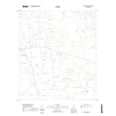
2019 Map of Tarkington Prairie
USGS Topo · Published 2019About this map
Tarkington Prairie and its surrounding wetlands define the rural character of this Liberty County landscape. The area is marked by a complex network of water features, including The Marsh and Bryants Marsh, which feed into local drainage systems like Board Slough and Indian Gulley. This modern survey reveals a community anchored by scattered historical landmarks, such as Boothe Cem and Lums Cem, alongside the small settlements of Macedonia and Upper Macedonia.
Find a feature on this map
104 named features on this map. Tap any name to fly to it.
Don’t see what you’re looking for? This feature index may not catch every label — zoom into the map to look around manually.
Map Details
Editions of this 2019 Tarkington Prairie Map
This is the sole edition of this map. No revisions or reprints were ever made.
Other maps of this area

1943 · Liberty
USGS Topo · 1:125,000

1954 · Beaumont
USGS Topo · 1:250,000

1955 · Rayburn
USGS Topo · 1:62,500

1955 · Liberty
USGS Topo · 1:62,500

1957 · Beaumont
USGS Topo · 1:250,000

1958 · Cleveland
USGS Topo · 1:24,000

1958 · Westcott
USGS Topo · 1:24,000

1959 · Plum Grove
USGS Topo · 1:24,000

1984 · Beaumont
USGS Topo · 1:250,000
1984 · Rayburn
USGS Topo · 1:24,000