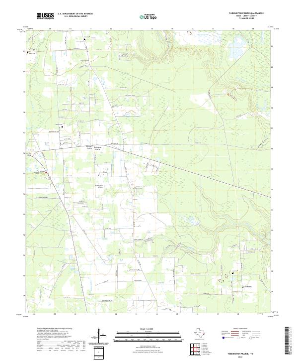
2022 Map of Tarkington Prairie
USGS Topo · Published 2022About this map
Tarkington Prairie and the surrounding Liberty County countryside are defined by a complex network of waterways and drainage patterns that have long shaped local settlement. Numerous small family or community burial grounds, such as Amos Cem, Oak Shade Cem, and Lums Cem, are scattered across the landscape, providing essential touchpoints for genealogical research in this part of East Texas. The terrain is marked by distinct hydrologic features including Bryant's Marsh and The Marsh to the west, while Gaylor Cr and Thickets Cr wind through the central and southern reaches.
Find a feature on this map
105 named features on this map. Tap any name to fly to it.
Don’t see what you’re looking for? This feature index may not catch every label — zoom into the map to look around manually.
Map Details
Editions of this 2022 Tarkington Prairie Map
This is the sole edition of this map. No revisions or reprints were ever made.
Other maps of this area

1943 · Liberty
USGS Topo · 1:125,000

1954 · Beaumont
USGS Topo · 1:250,000

1955 · Rayburn
USGS Topo · 1:62,500

1955 · Liberty
USGS Topo · 1:62,500

1957 · Beaumont
USGS Topo · 1:250,000

1958 · Cleveland
USGS Topo · 1:24,000

1958 · Westcott
USGS Topo · 1:24,000

1959 · Plum Grove
USGS Topo · 1:24,000

1984 · Beaumont
USGS Topo · 1:250,000
1984 · Rayburn
USGS Topo · 1:24,000