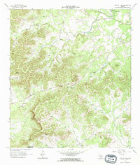
1964 Map of Tarpley Pass
USGS Topo · Published 1968About this map
The Bandera and Medina County line cuts diagonally across this Texas Hill Country landscape, marking a terrain defined by deep canyons and perennial springs. The Medina River flows through the northeast corner, bordered by the Highland Waters community and several gravel and borrow pits. Central to the sheet is the high crossing of Tarpley Pass, where the landscape transitions between the drainage basins of Commissioners Creek and the headwaters of West Verde Creek.
Find a feature on this map
29 named features on this map. Tap any name to fly to it.
Don’t see what you’re looking for? This feature index may not catch every label — zoom into the map to look around manually.
Map Details
Editions of this 1964 Tarpley Pass Map
3 editions found
Other maps of this area

1954 · San Antonio
USGS Topo · 1:250,000

1956 · Tarpley
USGS Topo · 1:62,500

1956 · Tuff
USGS Topo · 1:62,500

1956 · Bandera
USGS Topo · 1:62,500

1956 · Center Point
USGS Topo · 1:62,500

1957 · San Antonio
USGS Topo · 1:250,000

1964 · Bandera
USGS Topo · 1:24,000

1964 · Timber Creek
USGS Topo · 1:24,000

1964 · Rock Cliff Reservoir
USGS Topo · 1:24,000
1964 · A Bar A Ranch
USGS Topo · 1:24,000