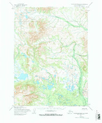
1954 Map of Taylor Mountains A-6
USGS Topo · Published 1968About this map
Tikchik Mountain rises prominently in the southwestern quadrant of this 1950s landscape, serving as a significant landmark in a region defined by an intricate network of glacial lakes and waterways. The drainage pattern is dominated by Klutuspuk Creek in the north and the meandering Koneruk Creek to the west, which flows through a dense collection of small, unnamed alpine lakes and ponds. Based on 1953 and 1955 aerial photography, the map reflects a wilderness state where no roads or trails are noted, emphasizing the isolation of the Taylor Mountains region. A distinct Ridge provides a high-altitude spine between the drainage basins of Arrow Creek and the surrounding valley floors, illustrating the geological transition between high peaks and the lake-strewn lowlands common to this part of the Alaska interior.
Find a feature on this map
6 named features on this map. Tap any name to fly to it.
Don’t see what you’re looking for? This feature index may not catch every label — zoom into the map to look around manually.
Map Details
Editions of this 1954 Taylor Mountains A-6 Map
2 editions found

Other maps of this area

1950 · Taylor Mountains
USGS Topo · 1:250,000

1951 · Taylor Mountains
USGS Topo · 1:250,000

1951 · Dillingham
USGS Topo · 1:250,000

1954 · Taylor Mountains
USGS Topo · 1:250,000

1954 · Dillingham
USGS Topo · 1:250,000

1954 · Dillingham D-6
USGS Topo · 1:63,360

1954 · Dillingham D-7
USGS Topo · 1:63,360
1954 · Dillingham D-5
USGS Topo · 1:63,360

1954 · Taylor Mountains B-7
USGS Topo · 1:63,360

1954 · Taylor Mountains B-5
USGS Topo · 1:63,360