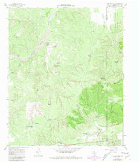
1966 Map of Tee Pee City
USGS Topo · Published 1981About this map
The Tee Pee City (Site), marked here with a Historical Marker, represents a fleeting moment of settlement in the Texas Panhandle. Located near the confluence of Tee Pee Creek and the Middle Pease River, this site was once a bustling supply point for buffalo hunters and early ranchers. By the time of this mid-century survey, the landscape had transitioned into a expansive ranching and conservation territory, including the southern portion of the Matador Wildlife Management Area.
Find a feature on this map
36 named features on this map. Tap any name to fly to it.
Don’t see what you’re looking for? This feature index may not catch every label — zoom into the map to look around manually.
Map Details
Editions of this 1966 Tee Pee City Map
2 editions found
Other maps of this area

1954 · Lubbock
USGS Topo · 1:250,000

1954 · Plainview
USGS Topo · 1:250,000

1958 · Plainview
USGS Topo · 1:250,000

1966 · Fields Canyon
USGS Topo · 1:24,000

1966 · Ballard Camp
USGS Topo · 1:24,000

1966 · Cee Vee
USGS Topo · 1:24,000

1966 · Tee Pee City
USGS Topo · 1:24,000

1966 · Devils Canyon
USGS Topo · 1:24,000

1967 · Turtle Hole Camp
USGS Topo · 1:24,000

1968 · Russellville
USGS Topo · 1:24,000