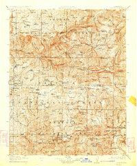
1905 Map of Tehipite
USGS Topo · Published 1924About this map
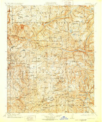
The High Sierra backcountry of Fresno and Tulare counties is documented here as it appeared following a 1903 survey, revealing an era of early industrial timber work and nascent conservation. Significant lumber operations are marked by the Sanger Lumber Co. and a network of facilities including Abbott Mill, Sanger Sawmill, and the Old Sawmill. These sites represent the heavy extraction that occurred on the fringes of what would become protected wilderness.
Find a feature on this map
202 named features on this map. Tap any name to fly to it.
Don’t see what you’re looking for? This feature index may not catch every label — zoom into the map to look around manually.
Map Details
Editions of this 1905 Tehipite Map
8 editions found
Other maps of this area

1903 · Tehipite
USGS Topo · 1:125,000

1904 · Kaiser
USGS Topo · 1:125,000

1904 · Kaweah
USGS Topo · 1:125,000

1905 · Tehipite
USGS Topo · 1:125,000

1905 · Olancha
USGS Topo · 1:125,000

1907 · Olancha
USGS Topo · 1:125,000

1907 · Mt. Whitney
USGS Topo · 1:125,000

1909 · Kaweah
USGS Topo · 1:125,000

1912 · Mt. Goddard
USGS Topo · 1:125,000

1913 · Bishop
USGS Topo · 1:125,000