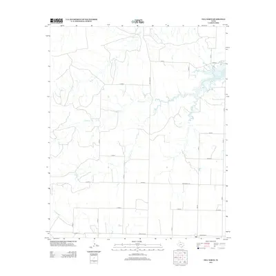
2012 Map of Tell North
USGS Topo · Published 2012About this map
The small community of Tell is situated in the southeastern corner of this Childress County landscape, serving as a focal point for a network of rural routes including Ranch Road 94 and Fm 2042. The area is defined by a dendritic drainage system feeding into Baylor Lake at the northeastern edge, where Baylor Cr and Cox Cr converge. Other significant waterways include the winding Rustlers Cr and the branching paths of N Baylor Cr and S Baylor Cr. The map reveals a strict section-line road grid, where numerous county roads like CO Road T and CO Road X delineate the agricultural and ranching properties that have historically shaped this part of the Texas Panhandle.
Find a feature on this map
24 named features on this map. Tap any name to fly to it.
Don’t see what you’re looking for? This feature index may not catch every label — zoom into the map to look around manually.
Map Details
Editions of this 2012 Tell North Map
This is the sole edition of this map. No revisions or reprints were ever made.
Other maps of this area

1954 · Plainview
USGS Topo · 1:250,000

1958 · Plainview
USGS Topo · 1:250,000

1961 · Memphis
USGS Topo · 1:62,500

1961 · Estelline
USGS Topo · 1:62,500

1967 · Tell South
USGS Topo · 1:24,000

1967 · Hell Roaring Creek
USGS Topo · 1:24,000

1967 · Tell North
USGS Topo · 1:24,000

1967 · Badger Nest Tank
USGS Topo · 1:24,000

1967 · Northfield
USGS Topo · 1:24,000

1967 · Carey
USGS Topo · 1:24,000