
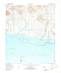
1950 Map of Teller B-4
USGS Topo · Published 1957About this map
Port Clarence and the expansive Breving Lagoon dominate this coastal survey of the Seward Peninsula, captured shortly after the mid-century. The landscape is defined by the shifting barrier spits and the Bering Sea coastline, where the Don River and California River drain from the inland highlands near Black Mtn. A significant historical landmark is the Point Spencer Airfield (Abd) at the tip of the spit, which is marked as abandoned by the time of this publication. Navigation across this subarctic terrain relied on seasonal routes, evidenced by the Winter Trail that tracks along the coast and across the lagoon. These trails provided critical winter access between coastal points like Point Jackson and Point Spencer when the waterways were frozen, illustrating the area's remote transportation network before modern infrastructure.
Find a feature on this map
17 named features on this map. Tap any name to fly to it.
Don’t see what you’re looking for? This feature index may not catch every label — zoom into the map to look around manually.
Map Details
Editions of this 1950 Teller B-4 Map
2 editions found
Other maps of this area

1950 · Teller
USGS Topo · 1:250,000

1950 · Teller C-3
USGS Topo · 1:63,360

1950 · Teller A-3
USGS Topo · 1:63,360

1950 · Teller C-4
USGS Topo · 1:63,360

1950 · Teller A-4
USGS Topo · 1:63,360

1950 · Teller B-3
USGS Topo · 1:63,360
1950 · Teller B-5
USGS Topo · 1:63,360

1950 · Teller C-5
USGS Topo · 1:63,360

1951 · Teller
USGS Topo · 1:250,000

1957 · Teller
USGS Topo · 1:250,000