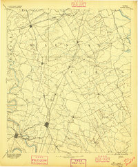
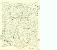
1892 Map of Temple
USGS Topo · Published 1896About this map
The rail hubs of Temple and Belton anchor this late nineteenth-century portrait of Central Texas, where the infrastructure of the Gulf Colorado & Santa Fe Railway and the Missouri Kansas & Texas Railway intersected to drive regional growth. Surveyed in 1890, the landscape is defined by the transition from the rolling prairie to the river bottoms of the Brazos River and Leon River. Local transport is marked by significant river points like Ross Crossing and Moores Crossing, which predated the more permanent bridge structures of the coming century.
Find a feature on this map
80 named features on this map. Tap any name to fly to it.
Don’t see what you’re looking for? This feature index may not catch every label — zoom into the map to look around manually.
Map Details
Editions of this 1892 Temple Map
6 editions found
Other maps of this area

1885 · Taylor
USGS Topo · 1:125,000

1887 · Taylor
USGS Topo · 1:125,000

1888 · Meridian
USGS Topo · 1:125,000

1892 · Temple
USGS Topo · 1:125,000

1892 · Waco
USGS Topo · 1:125,000

1893 · Georgetown
USGS Topo · 1:125,000

1894 · Meridian
USGS Topo · 1:125,000

1894 · Gatesville
USGS Topo · 1:125,000

1894 · Taylor
USGS Topo · 1:125,000

1920 · Waco
USGS Topo · 1:125,000