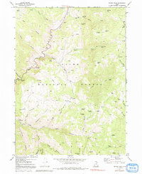
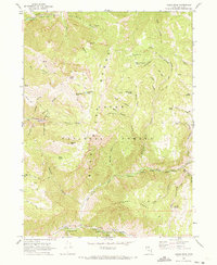
1969 Map of Temple Peak
USGS Topo · Published 1991About this map
Cache National Forest encompasses this high-elevation landscape, where the Logan River and its various tributaries have carved out prominent corridors like Logan Canyon. The 1969 data reflects a region heavily managed for recreation and resource use, evidenced by the clustered facilities such as the Lodge Campground, Twin Bridges Picnic Area, and the Lomia Girls Camp. Local history is embedded in the naming of remote landmarks like Ephraims Grave Spring and Hunsaker Corral, suggesting the area's legacy of ranching and early mountain passage.
Find a feature on this map
65 named features on this map. Tap any name to fly to it.
Don’t see what you’re looking for? This feature index may not catch every label — zoom into the map to look around manually.
Map Details
Editions of this 1969 Temple Peak Map
3 editions found
Other maps of this area

1912 · Randolph
USGS Topo · 1:125,000

1914 · Logan
USGS Topo · 1:125,000

1916 · Logan
USGS Topo · 1:125,000

1949 · Boulter Mts
USGS Topo · 1:24,000

1954 · Ogden
USGS Topo · 1:250,000

1958 · Ogden
USGS Topo · 1:250,000

1960 · Ogden
USGS Topo · 1:250,000
1969 · Tony Grove Creek
USGS Topo · 1:24,000

1969 · Boulder Mtn
USGS Topo · 1:24,000
1969 · Logan Peak
USGS Topo · 1:24,000