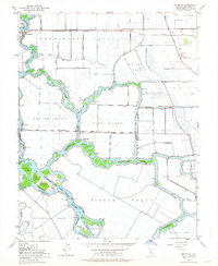
1952 Map of Terminous
USGS Topo · Published 1964About this map
The Western Pacific line and a complex network of man-made cuts and natural sloughs define this section of the California Delta in the early 1950s. Centered on the settlement of Terminous, the landscape is partitioned into reclaimed agricultural units like the Shin Kee Tract, King Island, and Rindge Tract. These low-lying areas are protected by extensive levee systems and connected by intricate water passages including White Slough and Disappointment Slough.
Find a feature on this map
51 named features on this map. Tap any name to fly to it.
Don’t see what you’re looking for? This feature index may not catch every label — zoom into the map to look around manually.
Map Details
Editions of this 1952 Terminous Map
3 editions found
Other maps of this area

1894 · Lodi
USGS Topo · 1:125,000

1910 · New Hope
USGS Topo · 1:31,680

1910 · Castle
USGS Topo · 1:31,680

1910 · Bouldin
USGS Topo · 1:31,680

1910 · Woodbridge
USGS Topo · 1:31,680

1910 · Headreach
USGS Topo · 1:31,680

1910 · Isleton
USGS Topo · 1:31,680

1913 · Woodward Island
USGS Topo · 1:31,680

1913 · Stockton
USGS Topo · 1:31,680

1913 · Holt
USGS Topo · 1:31,680