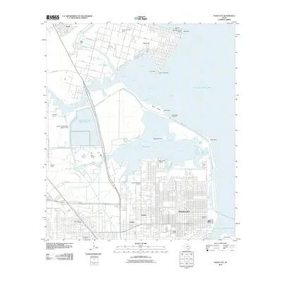
2010 Map of Texas City
USGS Topo · Published 2010About this map
Texas City and the surrounding shoreline of Galveston Bay reveal a landscape defined by industrial infrastructure and coastal settlements during this early 21st-century survey. The map details the complex water management and maritime features of the region, including the Galveston County Water Reservoir and its associated Dam, alongside the Moses Lake Tide Gate which regulates the flow between Moses Lake and Dollar Bay. This period shows a mixture of residential expansion in neighborhoods like Nadeau and Heights with specialized aviation and maritime facilities such as the B and S Ultralight Airport and San Leon Marina.
Find a feature on this map
52 named features on this map. Tap any name to fly to it.
Don’t see what you’re looking for? This feature index may not catch every label — zoom into the map to look around manually.
Map Details
Editions of this 2010 Texas City Map
This is the sole edition of this map. No revisions or reprints were ever made.
Other maps of this area

1916 · Seabrook
USGS Topo · 1:24,000

1920 · Seabrook
USGS Topo · 1:31,680

1929 · Dickinson
USGS Topo · 1:24,000

1929 · Hitchcock
USGS Topo · 1:24,000

1929 · Virginia Point
USGS Topo · 1:24,000

1929 · Texas City
USGS Topo · 1:24,000

1930 · Galveston
USGS Topo · 1:24,000

1932 · Clifton By The Sea
USGS Topo · 1:31,680

1932 · Dickinson
USGS Topo · 1:31,680
1932 · Seabrook
USGS Topo · 1:31,680