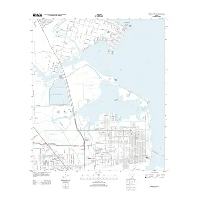
2013 Map of Texas City
USGS Topo · Published 2013About this map
San Leon and the northern reaches of Texas City define this coastal landscape where the industrial and maritime history of the Gulf Coast is on full display. The area's complex water management and infrastructure are visible through the large Galveston County Industrial Water Reservoir and the Galveston County Water Reservoir, which support the regional economy. Along the shoreline, prominent landmarks like Eagle Point, April Fool Point, and Dollar Point transition into the waters of Galveston Bay, while the inland reaches show a grid of development in the Heights and Nadeau neighborhoods. Genealogists can locate several significant burial sites, including the Phillips Memorial Cem, Rising Star Cem, and the Texas City Memorial Cem. Transportation and commerce are represented by Austinia Airport and the recreational access at Moses Lake Marina.
Find a feature on this map
79 named features on this map. Tap any name to fly to it.
Don’t see what you’re looking for? This feature index may not catch every label — zoom into the map to look around manually.
Map Details
Editions of this 2013 Texas City Map
This is the sole edition of this map. No revisions or reprints were ever made.
Other maps of this area

1916 · Seabrook
USGS Topo · 1:24,000

1920 · Seabrook
USGS Topo · 1:31,680

1929 · Dickinson
USGS Topo · 1:24,000

1929 · Hitchcock
USGS Topo · 1:24,000

1929 · Virginia Point
USGS Topo · 1:24,000

1929 · Texas City
USGS Topo · 1:24,000

1930 · Galveston
USGS Topo · 1:24,000

1932 · Clifton By The Sea
USGS Topo · 1:31,680

1932 · Dickinson
USGS Topo · 1:31,680
1932 · Seabrook
USGS Topo · 1:31,680