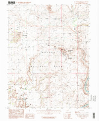
1985 Map of The Windows Section
USGS Topo · Published 1986About this map
Arches National Park reveals its mid-1980s landscape through this topographic survey, focusing on the concentration of natural formations within The Windows Section. The map documents the intricate geological features that define the region, including the North Window and South Window, alongside massive spires like the Tower of Babel and the Three Gossips. A network of 4wd roads and trails provides the primary means of navigation through the sandy floor of Salt Valley and up toward the Dry Mesa. At the southeastern edge, the Colorado River flows past the park boundary, while the interior is dotted with named landmarks such as Balanced Rock and the Parade of Elephants. This period of mapping emphasizes the transition from original manuscript drawings to modern digital photogrammetry, recording the exact placement of overlooks, picnic areas, and springs like Freshwater Spring before further recreational development occurred.
Find a feature on this map
41 named features on this map. Tap any name to fly to it.
Don’t see what you’re looking for? This feature index may not catch every label — zoom into the map to look around manually.
Map Details
Editions of this 1985 The Windows Section Map
2 editions found
Other maps of this area

1885 · La Sal
USGS Topo · 1:250,000

1952 · Moab 4 NW
USGS Topo · 1:24,000

1952 · Moab 4 SW
USGS Topo · 1:24,000

1954 · Mt. Waas 3 NW
USGS Topo · 1:24,000

1954 · Mt. Waas 3 SW
USGS Topo · 1:24,000

1954 · Castle Valley
USGS Topo · 1:62,500

1956 · Moab
USGS Topo · 1:250,000

1958 · Thompson
USGS Topo · 1:62,500

1958 · Cisco
USGS Topo · 1:62,500

1959 · Moab
USGS Topo · 1:250,000