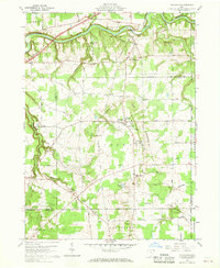
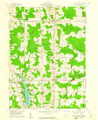
1960 Map of Thompson
USGS Topo · Published 1968About this map
The Grand River carves a winding path through the northern reach of this Geauga County landscape, where the dramatic terrain of The Ledges defines the central topography. In the early 1960s, the village of Thompson served as a local hub, anchored by the Ledgemont High Sch, Community Ch, and the Thompson Ledge Township Park. This period shows a rural environment transitioning through its geography, with the high ground of the ledges overlooking a network of family-named roads and small settlements like Griswold and South Madison. Genealogy researchers will find numerous rural landmarks, including the Maple Grove Cem and St Patricks Ch, while the presence of a Sand and Gravel Pit and an Airway Beacon points to the local industrial and navigational infrastructure of the era.
Find a feature on this map
42 named features on this map. Tap any name to fly to it.
Don’t see what you’re looking for? This feature index may not catch every label — zoom into the map to look around manually.
Map Details
Editions of this 1960 Thompson Map
4 editions found
Other maps of this area

1904 · Chardon
USGS Topo · 1:62,500

1905 · Ashtabula
USGS Topo · 1:62,500

1905 · Perry
USGS Topo · 1:62,500

1905 · Jefferson
USGS Topo · 1:62,500

1906 · Chardon
USGS Topo · 1:62,500

1907 · Jefferson
USGS Topo · 1:62,500

1950 · Cleveland
USGS Topo · 1:250,000

1953 · Chardon
USGS Topo · 1:24,000

1956 · Cleveland
USGS Topo · 1:250,000
1959 · East Claridon
USGS Topo · 1:24,000