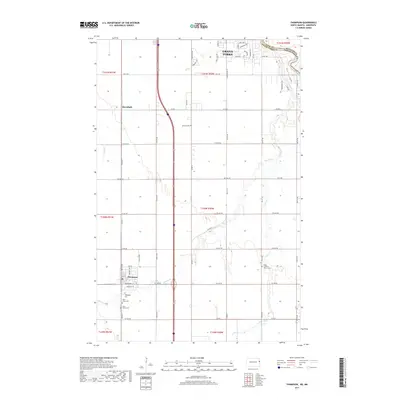
2017 Map of Thompson
USGS Topo · Published 2017About this map
Thompson and Merrifield anchor this Red River Valley landscape south of Grand Forks, where the intricate patterns of Elm Coulee and Cole Cr cut through the geometric grid of agricultural sections and township lines. The mapping reveals a high density of rural religious and memorial sites concentrated near the settlements, including the Walle Lutheran Church and its associated Walle Lutheran Church Cem. Further west, Saint Judes Cem and Saint James Cem sit just south of the Thompson town center. The drainage network is heavily managed, as evidenced by Drain Number 4 and Drain Number 10, which channel water toward the Red River of the North along the border between Minnesota and North Dakota. The juxtaposition of these modern water management features with early pioneer cemeteries provides a clear view of the area's development from frontier farmland into a stable agricultural corridor.
Find a feature on this map
53 named features on this map. Tap any name to fly to it.
Don’t see what you’re looking for? This feature index may not catch every label — zoom into the map to look around manually.
Map Details
Editions of this 2017 Thompson Map
This is the sole edition of this map. No revisions or reprints were ever made.
Other maps of this area

1919 · Eldred
USGS Topo · 1:62,500

1934 · Grand Forks
USGS Topo · 1:24,000

1934 · Grand Forks
USGS Topo · 1:62,500

1938 · Grand Forks
USGS Topo · 1:62,500

1952 · Grand Forks
USGS Topo · 1:250,000

1956 · Grand Forks
USGS Topo · 1:250,000
1963 · Mallory
USGS Topo · 1:24,000
1963 · Kelly
USGS Topo · 1:24,000
1963 · Grand Forks
USGS Topo · 1:24,000

1964 · Climax NW
USGS Topo · 1:24,000