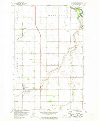
1971 Map of Thompson
USGS Topo · Published 1973About this map
Thompson and its surrounding agricultural townships serve as the focal point of this Red River Valley survey, conducted in the early 1970s. The landscape is defined by the rigid grid of North Dakota section lines, interrupted only by the meandering paths of Elm Coulee and Cole Creek. The Burlington Northern railroad corridor provides a primary north-south axis, connecting the community with the northern settlement of Merrifield.
Find a feature on this map
31 named features on this map. Tap any name to fly to it.
Don’t see what you’re looking for? This feature index may not catch every label — zoom into the map to look around manually.
Map Details
Editions of this 1971 Thompson Map
This is the sole edition of this map. No revisions or reprints were ever made.
Other maps of this area

1919 · Eldred
USGS Topo · 1:62,500

1934 · Grand Forks
USGS Topo · 1:24,000

1934 · Grand Forks
USGS Topo · 1:62,500

1938 · Grand Forks
USGS Topo · 1:62,500

1952 · Grand Forks
USGS Topo · 1:250,000

1956 · Grand Forks
USGS Topo · 1:250,000
1963 · Mallory
USGS Topo · 1:24,000
1963 · Kelly
USGS Topo · 1:24,000
1963 · Grand Forks
USGS Topo · 1:24,000

1964 · Climax NW
USGS Topo · 1:24,000