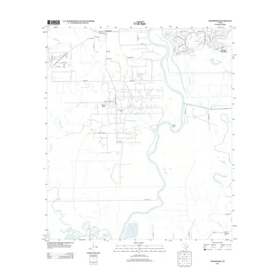
2013 Map of Thompsons
USGS Topo · Published 2013About this map
The Brazos River carves a winding path through this part of Fort Bend County, defining a landscape shaped by both petroleum extraction and suburban expansion in the early 21st century. The Thompsons Oil Field and the adjacent Humble Camp point to the area's industrial legacy, while the development of Sienna Plantation in the northeast corner illustrates the transition of historic land tracts into modern residential communities.
Find a feature on this map
69 named features on this map. Tap any name to fly to it.
Don’t see what you’re looking for? This feature index may not catch every label — zoom into the map to look around manually.
Map Details
Editions of this 2013 Thompsons Map
This is the sole edition of this map. No revisions or reprints were ever made.
Other maps of this area

1920 · Almeda
USGS Topo · 1:31,680

1943 · Rosharon
USGS Topo · 1:31,680

1943 · Juliff
USGS Topo · 1:31,680

1950 · Houston
USGS Topo · 1:250,000

1953 · Lake George
USGS Topo · 1:24,000

1953 · Damon
USGS Topo · 1:24,000

1953 · Otey
USGS Topo · 1:24,000

1953 · Thompsons
USGS Topo · 1:24,000
1955 · Almeda
USGS Topo · 1:24,000

1955 · Sugar Land
USGS Topo · 1:62,500