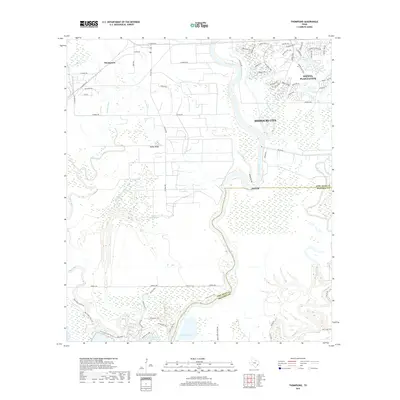
2019 Map of Thompsons
USGS Topo · Published 2019About this map
The Brazos River creates a wide, meandering boundary through this section of the Texas Gulf Coastal Plain, defining a landscape of wetlands and bayous south of Missouri City. The terrain is marked by a complex network of waterways, including Rabbs Bayou, Cottonwood Bayou, and Oyster Creek, illustrating the natural drainage patterns that have long influenced settlement in Fort Bend County. While residential development expands through Sienna Plantation and along roads like N Thompson Rd, the southern reaches remain characterized by conservation and recreation. The presence of Reservoir Number 8 and an extensive trail system, including the Big Creek Loop Trail and Bluestem Trail, highlights the modern management of these traditional bottomlands. Smaller communities like Thompsons and Rabbs Ridge stand as anchors within a landscape transitioned from historic agricultural use to contemporary suburban growth and flood control.
Find a feature on this map
75 named features on this map. Tap any name to fly to it.
Don’t see what you’re looking for? This feature index may not catch every label — zoom into the map to look around manually.
Map Details
Editions of this 2019 Thompsons Map
This is the sole edition of this map. No revisions or reprints were ever made.
Other maps of this area

1920 · Almeda
USGS Topo · 1:31,680

1943 · Rosharon
USGS Topo · 1:31,680

1943 · Juliff
USGS Topo · 1:31,680

1950 · Houston
USGS Topo · 1:250,000

1953 · Lake George
USGS Topo · 1:24,000

1953 · Damon
USGS Topo · 1:24,000

1953 · Otey
USGS Topo · 1:24,000

1953 · Thompsons
USGS Topo · 1:24,000
1955 · Almeda
USGS Topo · 1:24,000

1955 · Sugar Land
USGS Topo · 1:62,500