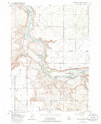
1949 Map of Thousand Springs
USGS Topo · Published 1986About this map
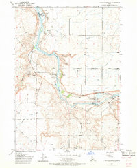
Snake River canyon walls define this stretch of Idaho, where the porous volcanic rock releases an extraordinary volume of water at Thousand Springs. This 1949 survey illustrates the mid-century development of the region's unique geothermal and hydraulic resources. The Banbury Natatorium and nearby Hot Water Wells signify the era's commercial interest in natural hot springs, while the Powerhouse near the springs captures the industrial harnessing of the river's descent. In the higher agricultural lands, the Lucerne School serves the rural community of Melon Valley. The terrain is marked by dramatic geological formations like Box Canyon and Blind Canyon, which feed into the main canyon alongside Salmon Falls Creek. Navigation and irrigation are prominent themes, evidenced by the numerous ditches and the turbulent waters of Devil's Washbowl Falls and Kanaka Rapids.
Find a feature on this map
26 named features on this map. Tap any name to fly to it.
Don’t see what you’re looking for? This feature index may not catch every label — zoom into the map to look around manually.
Map Details
Editions of this 1949 Thousand Springs Map
7 editions found
Other maps of this area

1949 · Thousand Springs
USGS Topo · 1:24,000

1949 · Tuttle
USGS Topo · 1:24,000

1949 · Hagerman
USGS Topo · 1:24,000

1950 · Hagerman
USGS Topo · 1:24,000

1950 · Niagara Springs
USGS Topo · 1:24,000

1950 · Jerome
USGS Topo · 1:62,500

1951 · Thousand Springs
USGS Topo · 1:24,000

1951 · Tuttle
USGS Topo · 1:24,000

1951 · Clover
USGS Topo · 1:24,000

1954 · Thousand Springs
USGS Topo · 1:24,000